| land use
A couple of days ago I was amazed by a series of photographs of the entire California coast. It turns out that the same thing has been done for Washington — completed in 1997.
Shoreline Ariel Photos
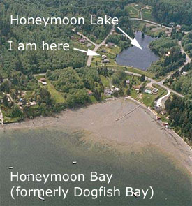 Between 1992 and 1997, the Washington State Department of Ecology acquired oblique aerial photography of the state's entire 2,500 miles of marine shoreline. Between 1992 and 1997, the Washington State Department of Ecology acquired oblique aerial photography of the state's entire 2,500 miles of marine shoreline.
The collection of over 10,000 photographs provides a valuable educational monitoring tool for coastal managers and the public. The true- color photos comprise a continuous series, panning left to right along the shoreline. The photos were taken to optimize sun angle, shoreline orientation, and low tides. Oblique photos are useful for interpreting bluff geology and land-sliding, riparian vegetation, and shoreline modifications such as bulkheads and seawalls.
[more]
thanks to Spitting Image |